Global Adventurer
Global Adventurer is a hiking app for iPhone and Apple Watch: a topographic map drawn for walkers, one-tap recording, routes that still work without a signal, and the details Mountain Rescue asks for on a single screen.
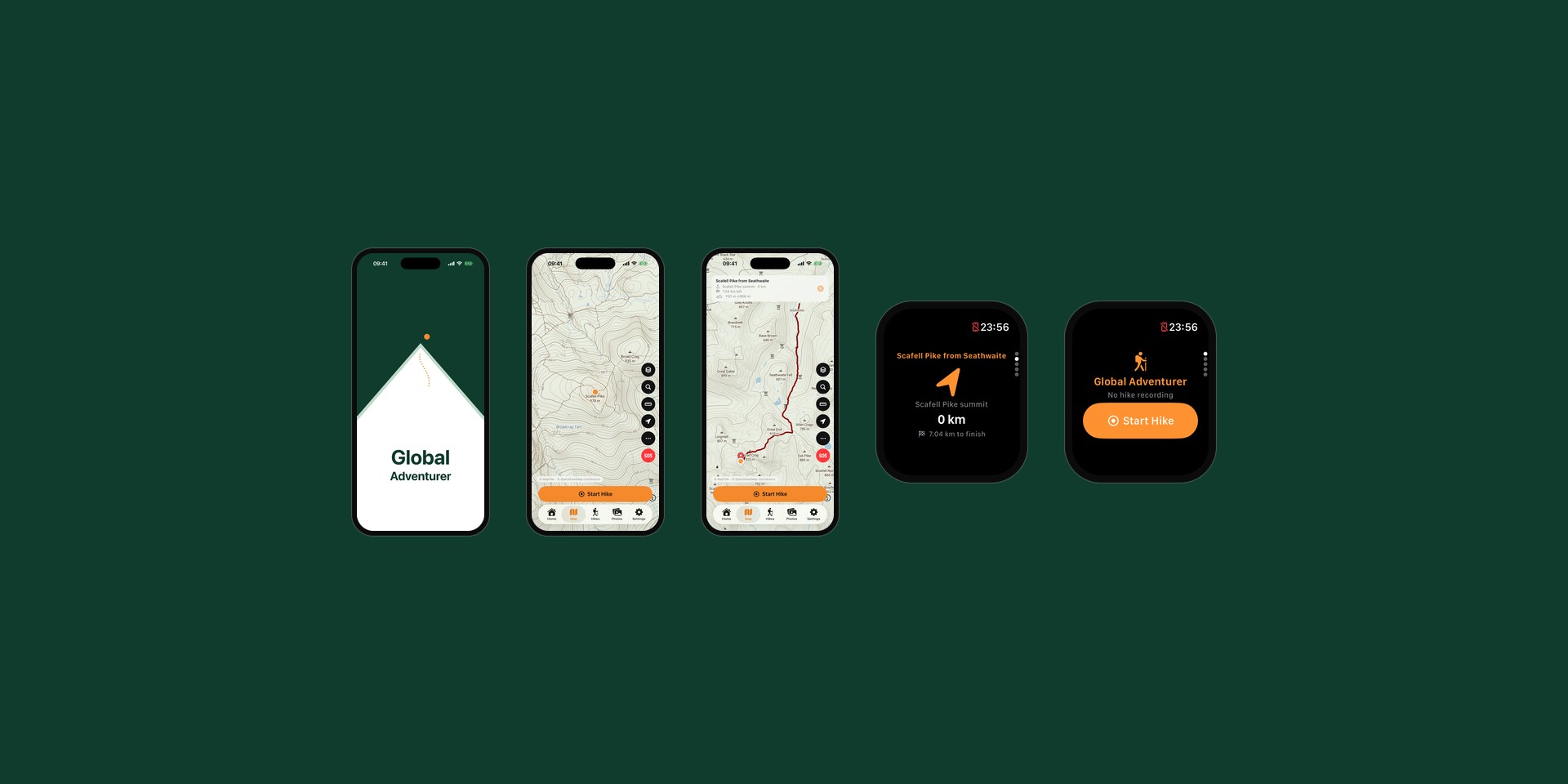

A map drawn for walking
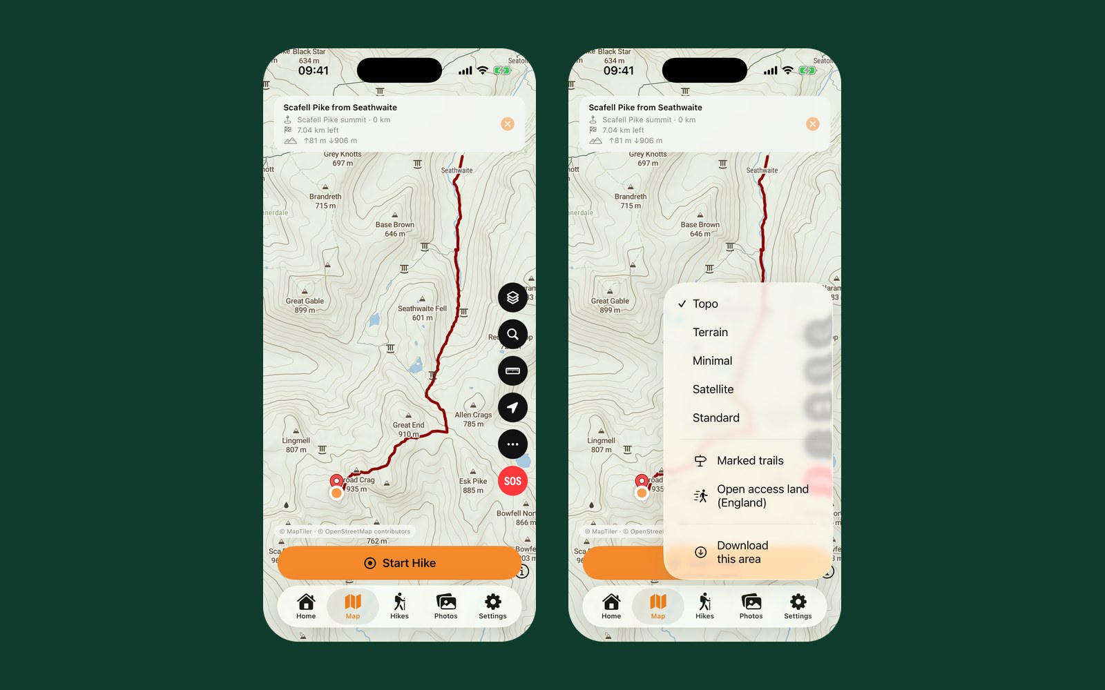
Global Adventurer draws its own topographic map, styled for people on foot rather than in cars. Paths and contours come first, roads stay quiet, and orange and red are kept for the walker’s own track and route, so they never get lost in the map. Walkers can switch between Topo, Terrain, Minimal, Satellite and Standard views, show marked trails, and see open access land in England.
Maps can be downloaded for an area, or along the length of a route, before setting off. When a walker follows a saved or imported route, a panel at the top shows the next waypoint, the distance left and the climb and descent still to come.
Every hike recorded and easy to find
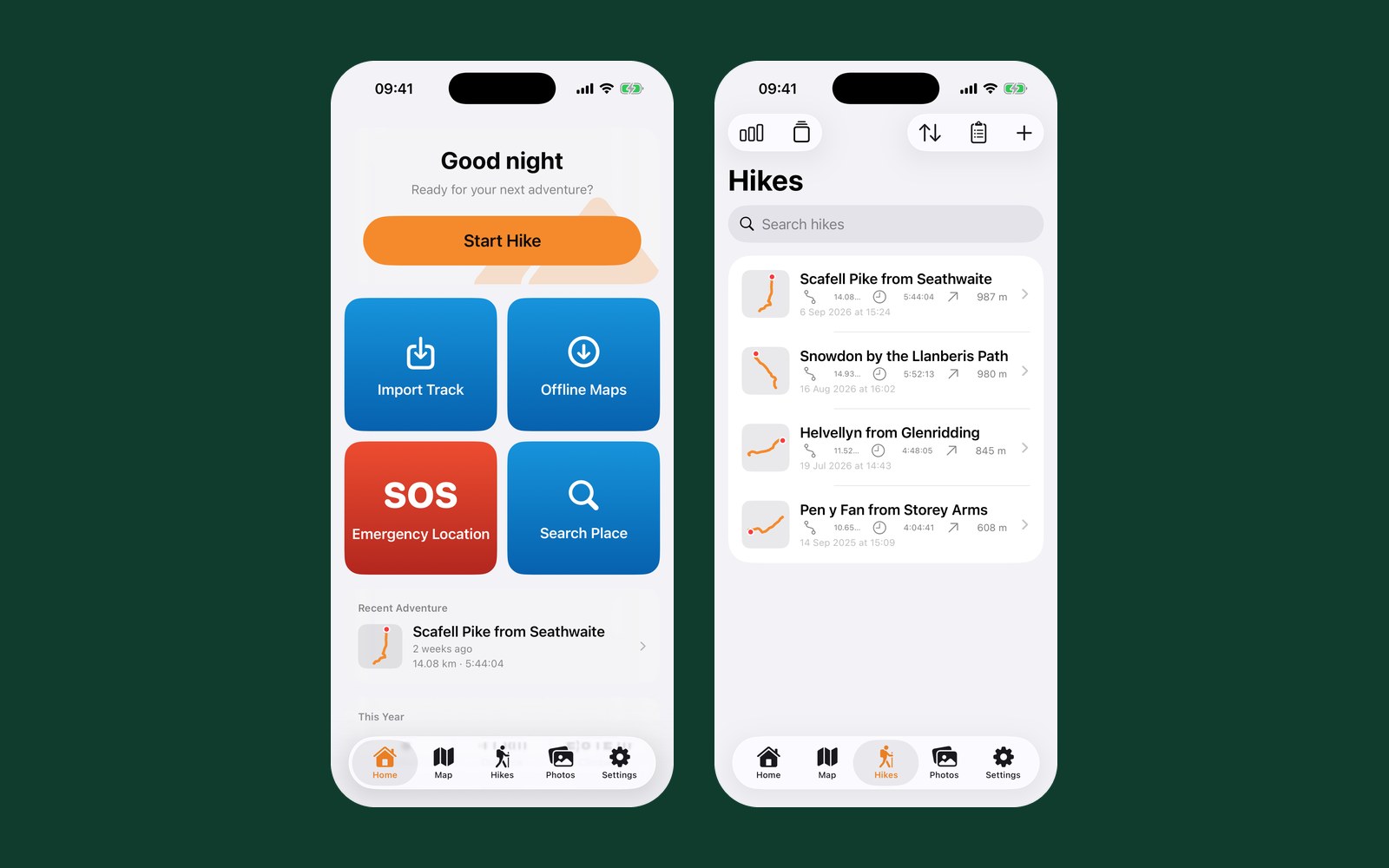
One tap starts a hike. Distance, time and ascent update as the walker moves, recording carries on with the screen off, and progress shows on the Lock Screen. If the phone runs out of memory mid-walk, the hike is recovered the next time the app opens.
Saved hikes are listed with a small drawing of each route, and can be searched, sorted, renamed and grouped into collections. The home screen shows the most recent adventure, the year so far and a walk from the same day in an earlier year. Hikes can be imported from GPX, KML, CSV and other common formats, exported again, and saved to Apple Health as workouts.
Help when it matters most
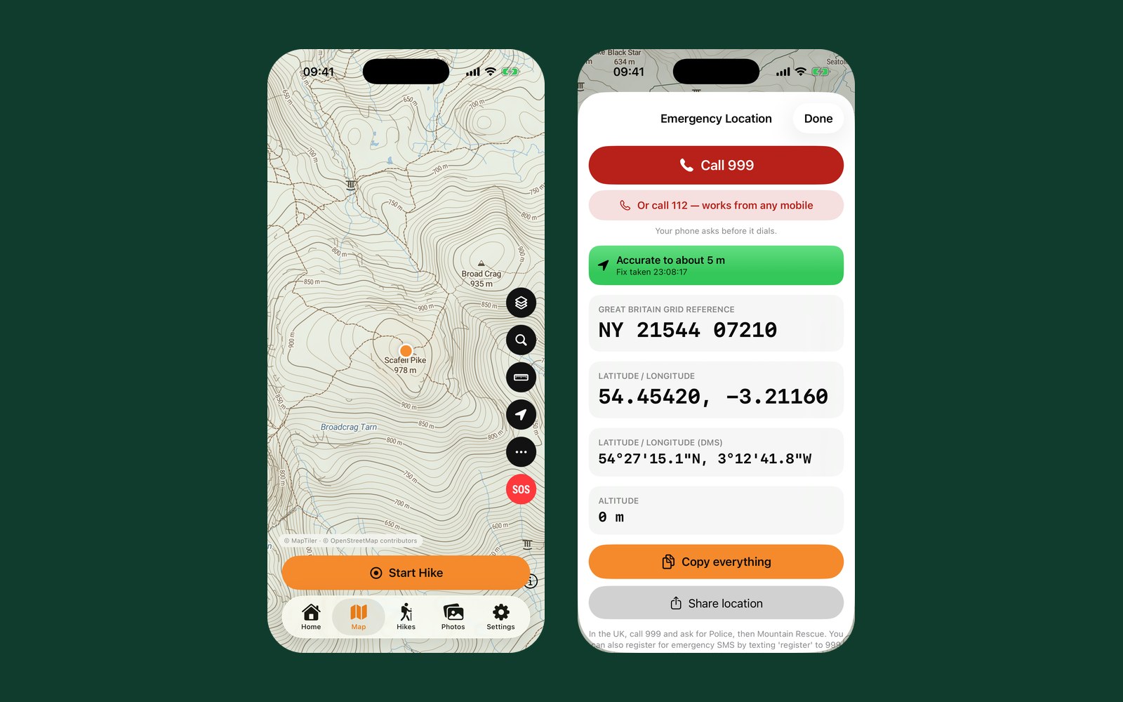
A red SOS button sits on the map at all times. It opens an Emergency Location screen with buttons to call 999 or 112, and shows the walker’s position in large, high-contrast type: a British or Irish grid reference, latitude and longitude in two formats, altitude and how accurate the GPS fix is. Everything can be copied or shared in one tap, ready to read out to Mountain Rescue.
While a route is being followed, the app warns the walker with a vibration, a banner and a spoken alert if they stray from the line, and confirms when they are back on it.
Private, native and in eight languages
eplatforms built Global Adventurer natively for iPhone, with maps drawn on the phone itself, so labels stay crisp at every zoom. There is no account to create, and hikes stay on the phone unless the walker exports them or backs them up to their own iCloud.
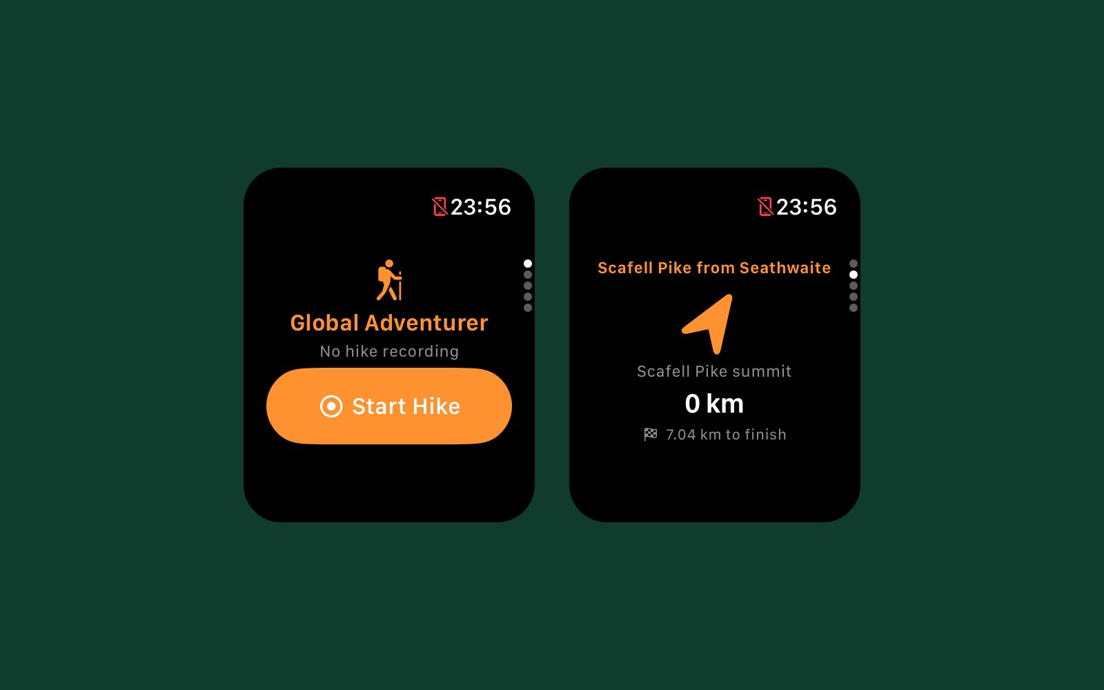
- An Apple Watch app shows the stats, a bearing to the next point and an offline map, and can record a hike with the phone left behind
- Siri and the Action button can start and stop a hike
- The app speaks English, French, German, Norwegian, Swedish, Korean, Hebrew and Arabic, with right-to-left layouts for Arabic and Hebrew
A calm companion for a day on the hill
Related service: Mobile App Development
Related Case Studies

Order Exceptions
Our own refund-monitoring app: it reads the payment transaction rather than the refund record, and tells merchants when the money has not actually reached the customer.
Read the story
GINA
Luxury ecommerce. Learn how we improved the online and mobile presence of a luxury brand with a global customer base and tailored results to users' needs.
Read the story
Urban Industry
How a B2C sales platform, multichannel integration and strategic advice helped an award-winning streetwear retailer become a major online player.
Read the story